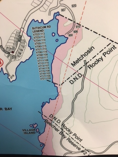
The following graphics demonstrate the possible inundation areas (in PINK). If you live inside these areas, you are considered in the High Risk Hazard Zone for Tsunami – and should prepare accordingly.
click on map for a larger version
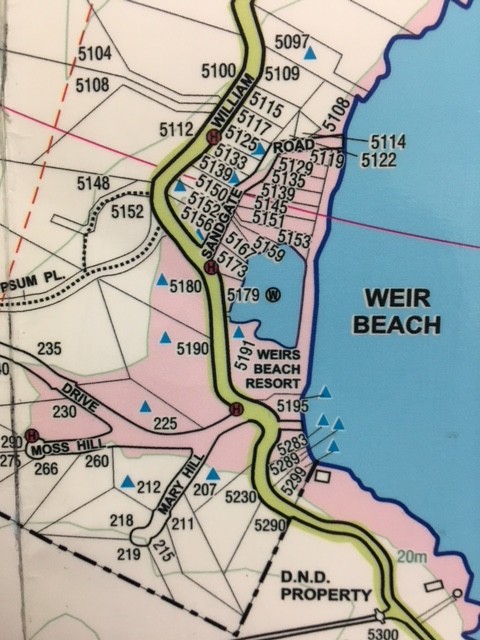
WEIRS BEACH AREA
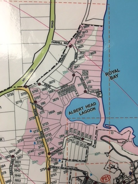
ALBERT HEAD LAGOON, PARK DRIVE AND DUKE ROAD AREA
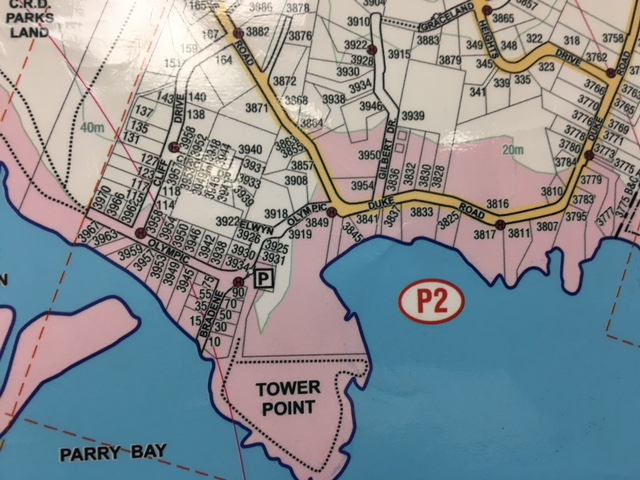
TOWER POINT / DUKE ROAD AREA
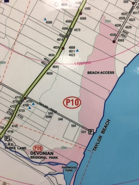
TAYLOR BEACH AREA
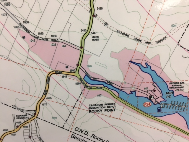
MATHESON LAKE PARK & ROCKY POINT ROAD
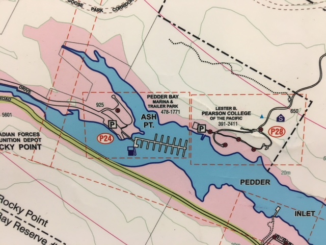
PEDDER BAY / PEARSON COLLEGE
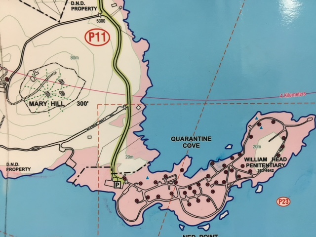
WILLIAM HEAD PRISON & AREA
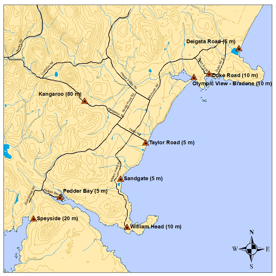
METCHOSIN ELEVATION POINTS
SPEYSIDE, DND AND COASTAL AREA